|
| *****SWAAG_ID***** | 726 |
| Date Entered | 10/05/2013 |
| Updated on | 10/05/2013 |
| Recorded by | Tim Laurie |
| Category | Tree/Shrub Record |
| Record Type | Geological HER |
| Site Access | Public Access Land |
| Record Date | 06/05/2013 |
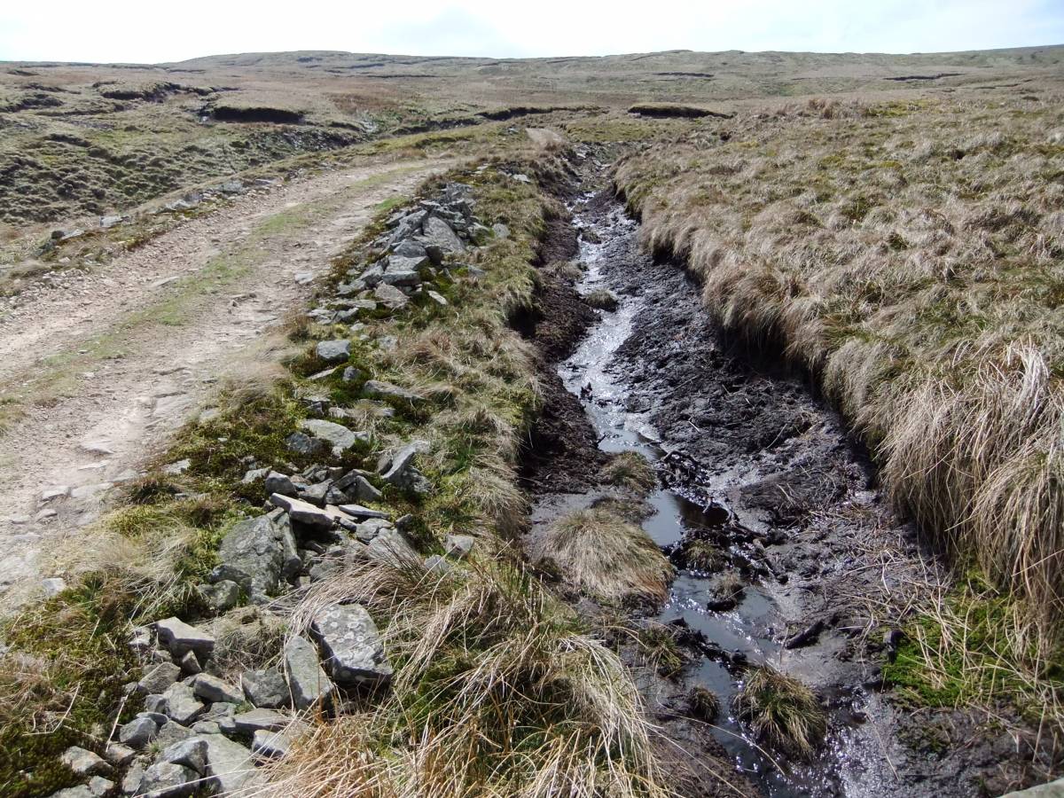
| Location | Walden Head. Fossegill Pike. |
| Civil Parish | Burton cum Walden |
| Brit. National Grid | SD 96993 78907 |
| Altitude | 538m |
| Geology | Base of thin (.7m deep)blanket peat over Richmond Chert Strata. |
| Record Name | Fossedale Pike.Remains of Juniper below blanket peat at 538m AOD.. |
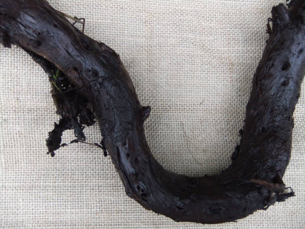
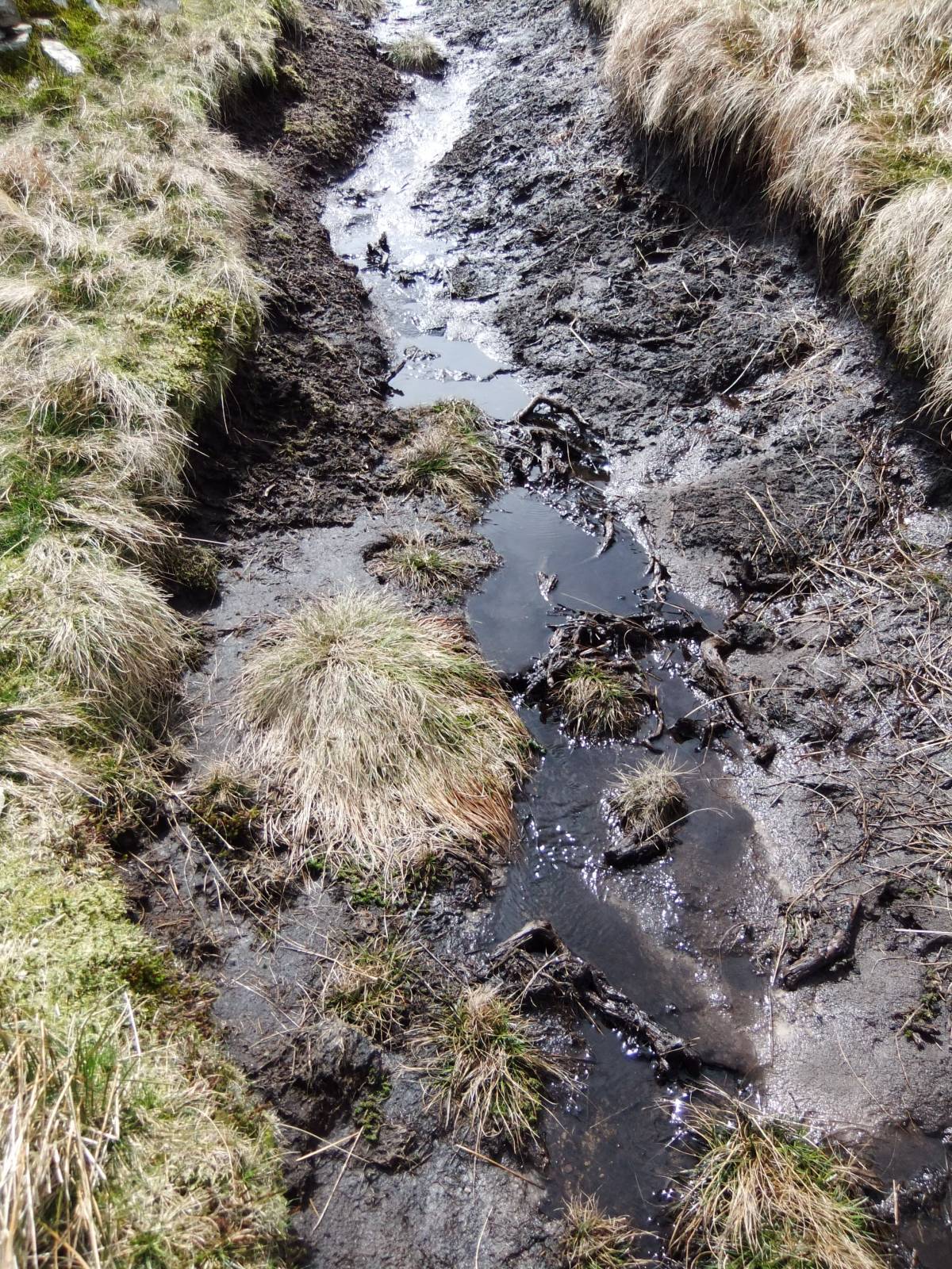
| Record Description | Remains of juniper (identification provisional, pending independent confirmation) visible at base of thin blanket peat in drainage gully at side of shooting track. |
| Dimensions | See photos |
| Additional Notes | Juniper has not been recorded recently in Wensleydale but was recorded at four locations in the Ure Catchment in the Flora published by John Percival in 1888. (Millward, D 1988. 'A Flora of Wensleydale'. Yoredale Natural History Soc.). These records have not been recently confirmed. |
| Image 1 ID | 4421 Click image to enlarge |
| Image 1 Description | Walden. Fosse Gill Head. Juniper remains below peat at 538m AOD. | 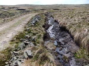 |
| Image 2 ID | 4422 Click image to enlarge |
| Image 2 Description | Juniper remains preserved under peat. Detail. | 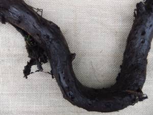 |
| Image 3 ID | 4423 Click image to enlarge |
| Image 3 Description | Walden. Fosse Gill Head. Juniper remains below peat at 538m AOD. | 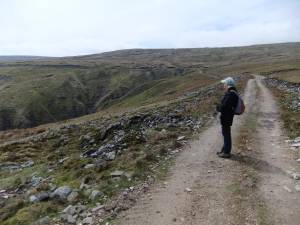 |
| Image 4 ID | 4424 Click image to enlarge |
| Image 4 Description | Walden. Fosse Gill Head. Juniper remains in drain below peat at 538m AOD. | 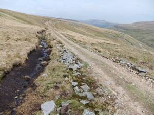 |
| Image 5 ID | 4425 Click image to enlarge |
| Image 5 Description | Walden. Fosse Gill Head. Juniper remains below peat at 538m AOD. |  |